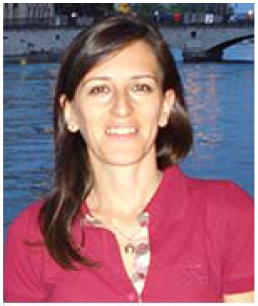
Invited Speaker

Prof. Valentina Lentini
Faculty of Engineering and ArchitectureUniversity Kore of Enna
Italy
Speech Title: Dynamic characterization of soils by laboratory testing for seismic risk assessment
Abstract: Thematic maps, such as seismic risk maps, are a useful tool that researchers use for representing the adverse outcomes that a natural catastrophic event can have over the territory. Generally, in those studies, major attention is focused in urban areas, where the human activities are concentrated. Main concerns are about the existing building stock, mostly composed by structures not compliant with modern seismic design criteria. The realization of a risk map is a complex task that involves the combination of data coming from different field of expertise, such as geology, geotechnical and structural engineering.
The paper describes how the application of prospecting and surveying techniques (geological surveys, drilling, down-hole, MASW) allowed a decisive improvement in the geological knowledge of the area, contributing to define the subsoil model for the purposes of seismic microzonation. The interpretation of geophysical and geotechnical data and their correlation with geological units are explained and finally the microzonatic map is presented. The paper also reports the seismic geotechnical characterization executed with laboratory tests including the resonant column and cyclic torsional shear test on undisturbed samples. The results are summarized in terms of variation of stiffness and damping with shear strain. Finally, the use of wireless sensor technology for structural monitoring has significant benefits when the time available for access is often severely limited, by representing an effective way of managing risks once that an area of concern has been identified. The aim of the study is the acquisition of a local knowledge on issues related to seismic risk that may affect urban areas, through the acquisition, management and sharing of complex information. The available information, collected by sensor network, have been combined together in a Geographical Information System tool. The results provide a reliable representation of the seismic risk at urban scale to be used when planning the mitigation measures to be undertaken in order to improve the prevention and reduction of the disastrous effects of the earthquakes.
Keywords: Seismic risk, Web-GIS platform, Monitoring, Sensor network
Biography: Valentina Lentini is Assistant professor of Geotechnical Engineering at the University Kore of Enna (Italy). The research activities is mainly devoted to geotechnical earthquake engineering with particular reference to the soil dynamic characterization by means of laboratory test but also to landslide risk and shallow foundation. She has published more than 80 papers in in international journals and conference proceedings. Valentina Lentini is member of the Editorial Board of Bulletin of Engineering Geology and the Environment. She is actively involved in the management of activities of the Soil Dynamics and Geotechnical Engineering Laboratory of the University of Enna. She is part of a research group involved in numerous research projects with the Italian Ministry of Scientific Research.
